

Through postcards, stereoviews, and other advertising and promotional material, Magnolia Avenue became famous even outside of Riverside. Extending southwest from Arlington Avenue, the picturesque avenue with a tree-lined center strip showcased the homes of early citrus growers. However, the street was not directly connected to downtown Riverside. For example, the Riverside and Arlington Electric Railway ran up Magnolia, turned right at Arlington Avenue, then left onto Brockton Avenue before proceeding north to downtown.
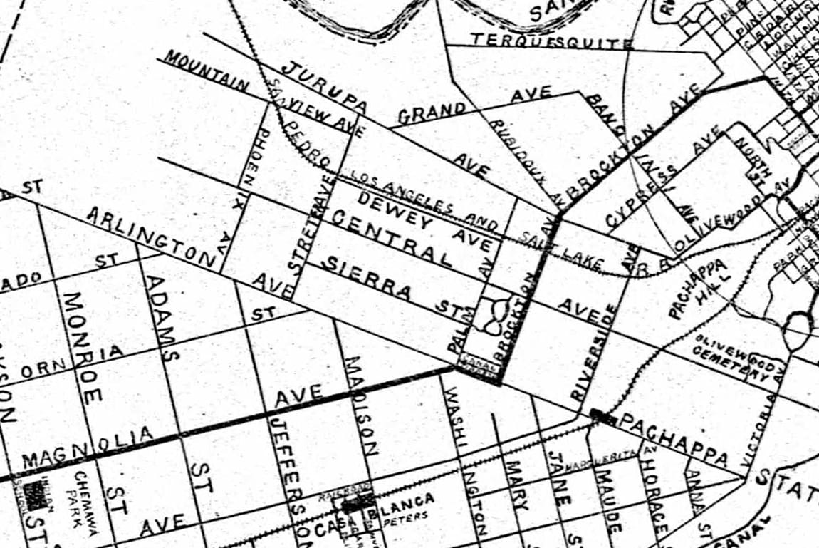
A more direct route was wished for by many. By 1908, plans were underway to accomplish this. The newspaper announced that rights-of-way were secured from Arlington Avenue to Thirteenth Street. The only question was whether to build a bridge over Arroyo, such as was built on Victoria Avenue, or to fill in the ravine. The decision was made to fill in the Tequesquite Arroyo as the new road approached the mile square of downtown Riverside.
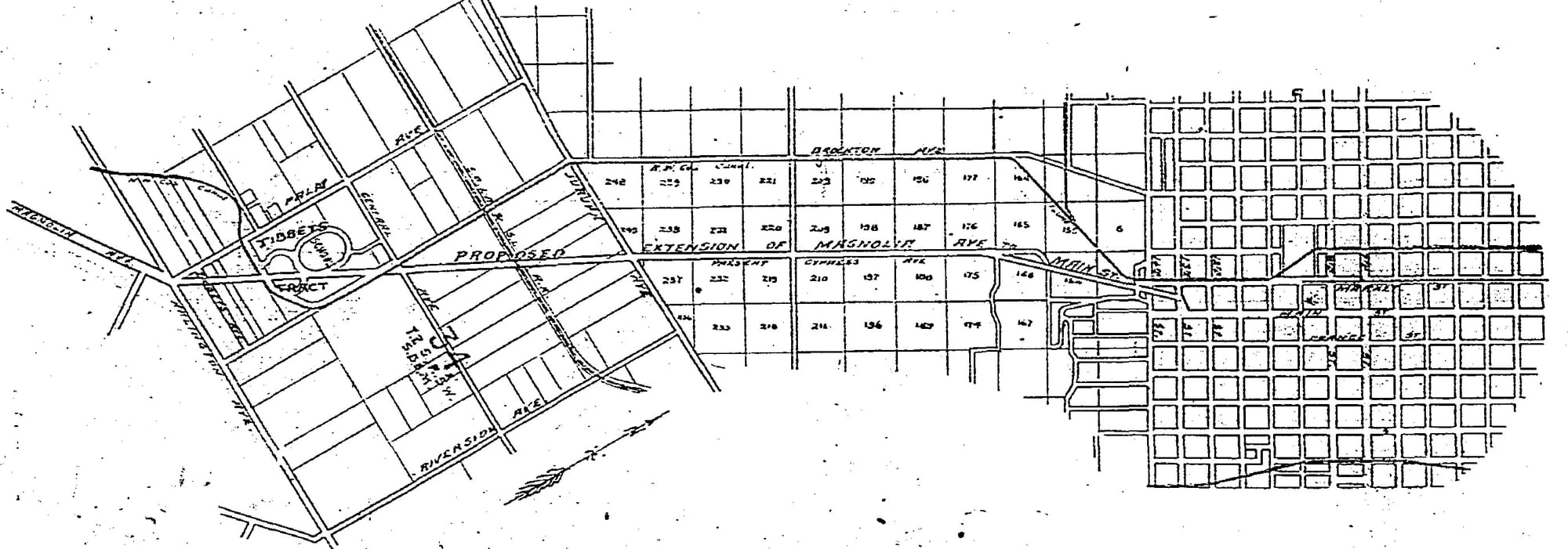
A new road was built from Arlington Avenue to Jurupa Avenue through the Government Land Tract. The new route made a slight right bend as it left Arlington and, at Jurupa, joined Cypress Avenue, which was renamed Magnolia Avenue.
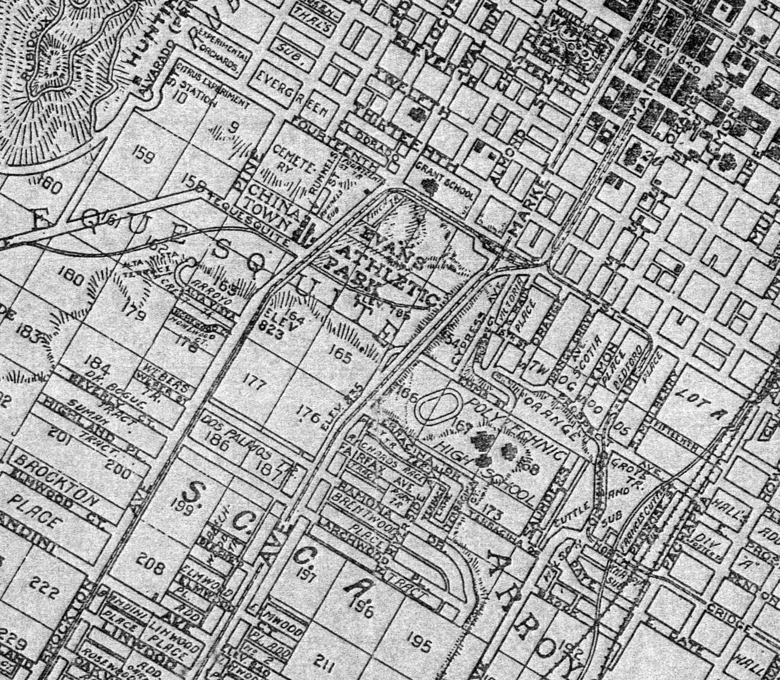
Cypress Avenue was an early street below the mile square of downtown. According to historian Tom Patterson, Cypress Avenue "originally crossed Tequesquite Arroyo by a tortuous route, slanting downward and eastward along the south bank of the Arroyo within the present Riverside Community College campus. A remnant of old Cypress remains today under the name of Stadium Way, climbing from the RCC athletic field to Fourteenth Street," (see above 1905 map).
The 1892-93 History and Directory of Riverside County lists about twenty homes with a Cypress address. Two prominent names of the day were Deloraine Chapman and Ernst A. Meacham.
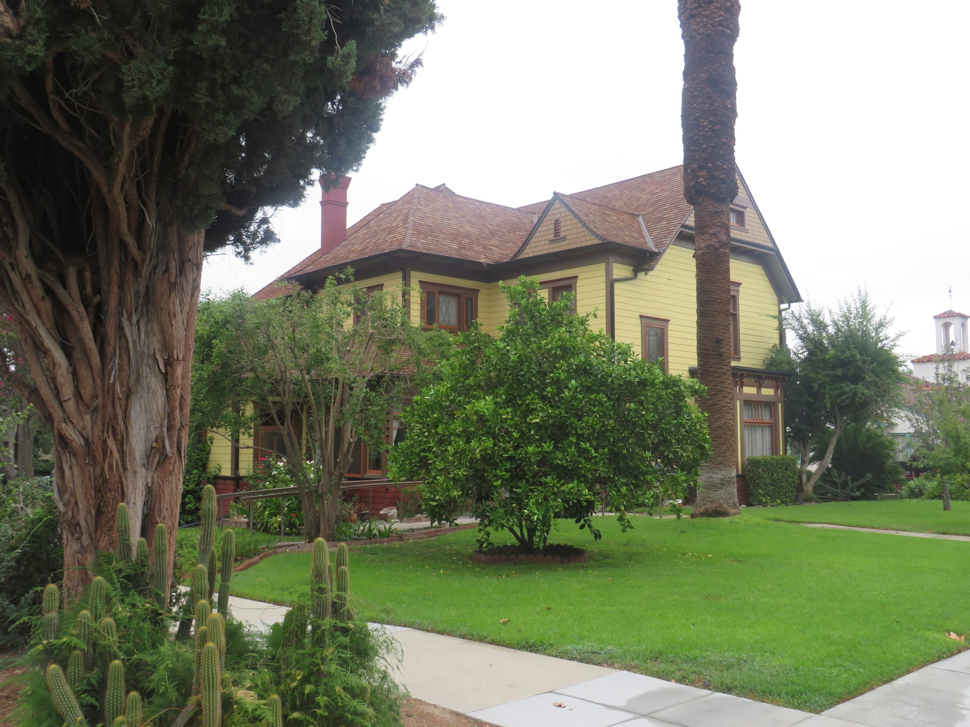
In 1887, Chapman built his home at 257 Cypress Avenue (today 5081 Magnolia Avenue) on twenty acres, where he planted citrus trees. After his death, his daughters deeded a portion of the land through his property to the city for a street so the land could be subdivided for homes. That street is Chapman Place. The old Chapman home sits on the corner of Magnolia Avenue and Chapman Place.
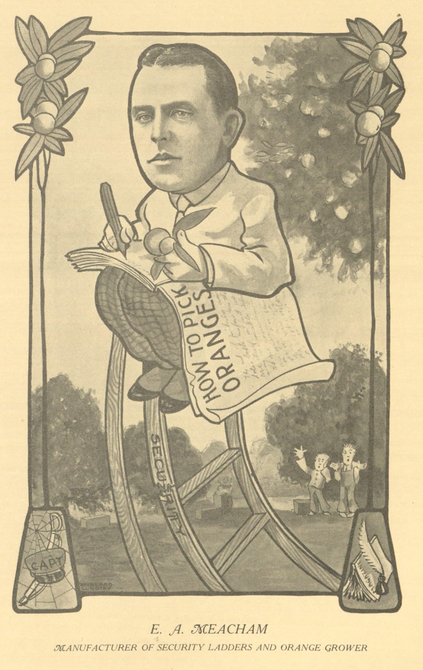
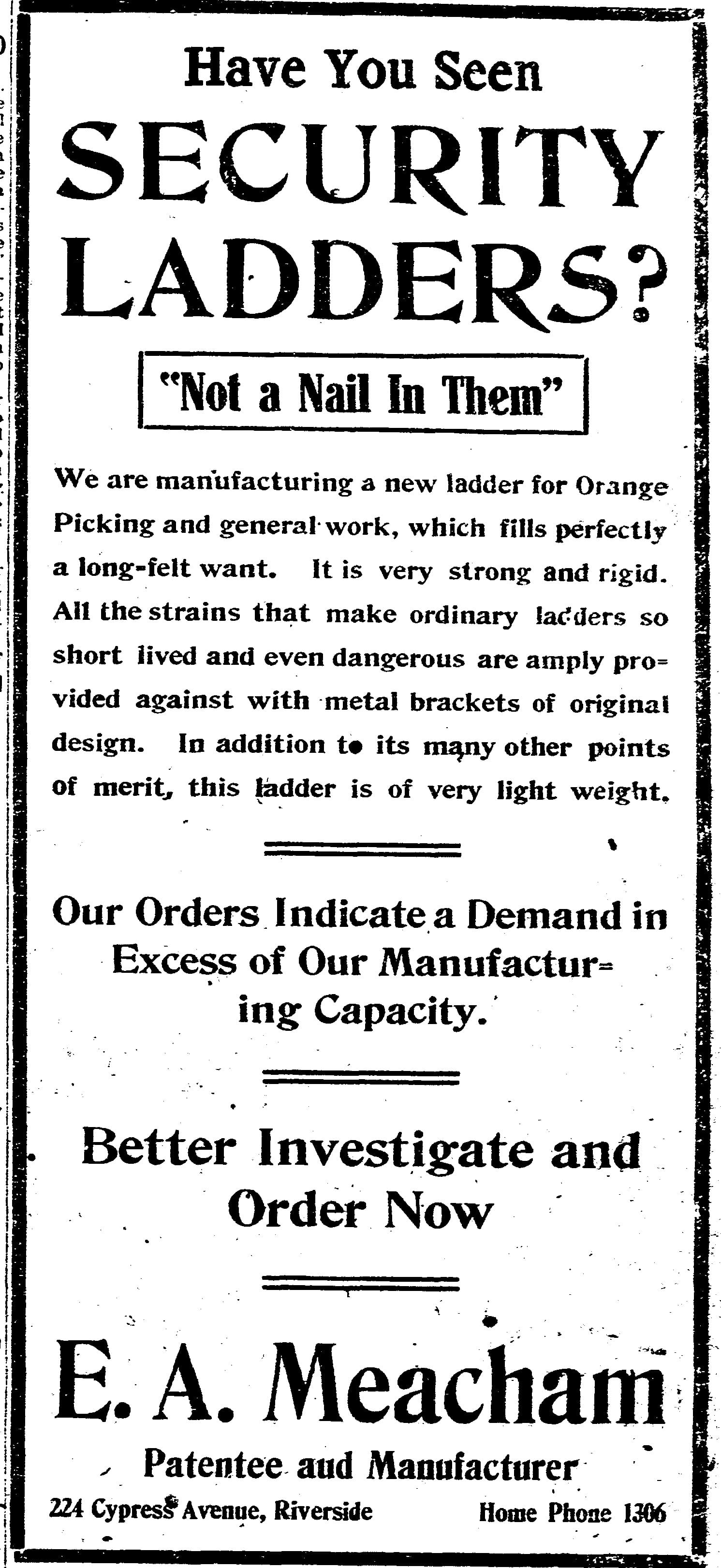
Meacham moved to Riverside in 1887 with his parents. He was an early director of the Pachappa Orange Growers Association. He also invented a Frost Protection Apparatus and held a patent on a security ladder for use in the orange groves. He ran his business out of his home at 224 Cypress Avenue, which was set on thirty acres of grove property. Meacham was a strong supporter of the Magnolia extension and willingly donated land for the widening of the avenue.
Another supporter of the Magnolia Avenue extension was Gustav O. Newman. He had married Emma Miller, the sister of Frank A. Miller of the Mission Inn. Newman stated that "the proposed extension was one of the greatest things ever attempted for the benefit of the city." However, he was vehemently opposed to the fill, claiming it would be unattractive and spoil the entrance to the city. Instead, he felt a concrete bridge was the correct answer. Part of Newman's objection was probably that the fill required seven acres of his property located on the south side of Fourteenth Street. The south side of his ranch property was bordered by Emma Street, a street named for his wife, which no longer exists.
On the last day of December 1908, City Attorney Purington began condemnation proceedings against Newman to acquire the right-of-way through his property. By the end of July 1909, the Daily Press reported that a gift to the city by G. O. Newman transferred the deed of a 100-foot strip of land from G. O. Newman near Fourteenth and Main Street for the completion of the extension of Magnolia Avenue. A small triangular portion of land bounded by the splitting of Magnolia Avenue to join both Market and Main Streets and with Fourteenth Street at the north end became what is now Newman Park, the site of the Juan Bautista De Anza statue.
Planning work and property acquisition continued for the extension through 1910, with the first actual shovels of dirt turned on January 22, 1912. The Star Cement Company, a local Riverside company, obtained the contract and had over 200 men on the job. The contract paid about 18 cents for every cubic yard of dirt used for the fill. A disastrous event almost occurred on July 18, 1912, when the 70-ton steam shovel used on the project partially tipped over, narrowly missing a teamster and his horses. The newspaper reported that "the accident was due to so innocent a thing as a gopher hole or a pocket caused by irrigation." The crew was able to get the shovel back in its upright position and work commenced the next day.
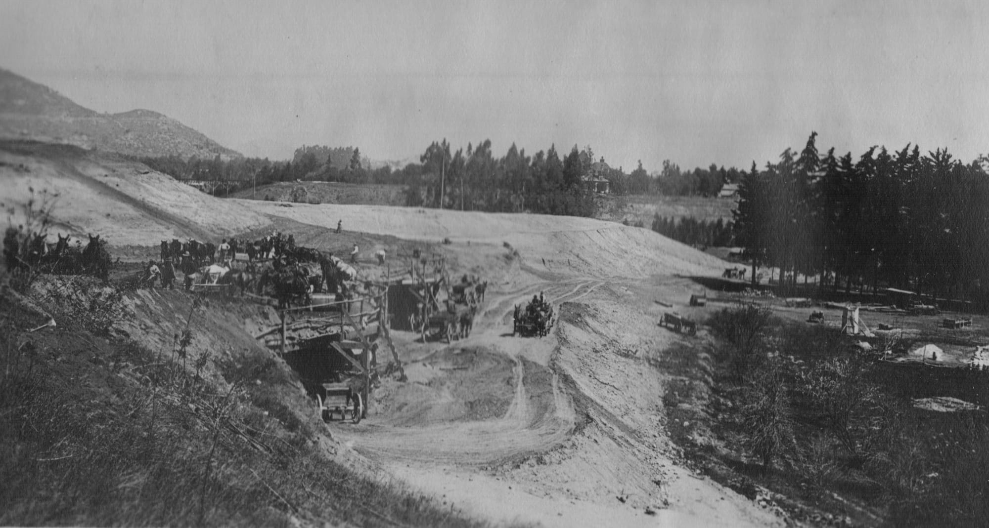
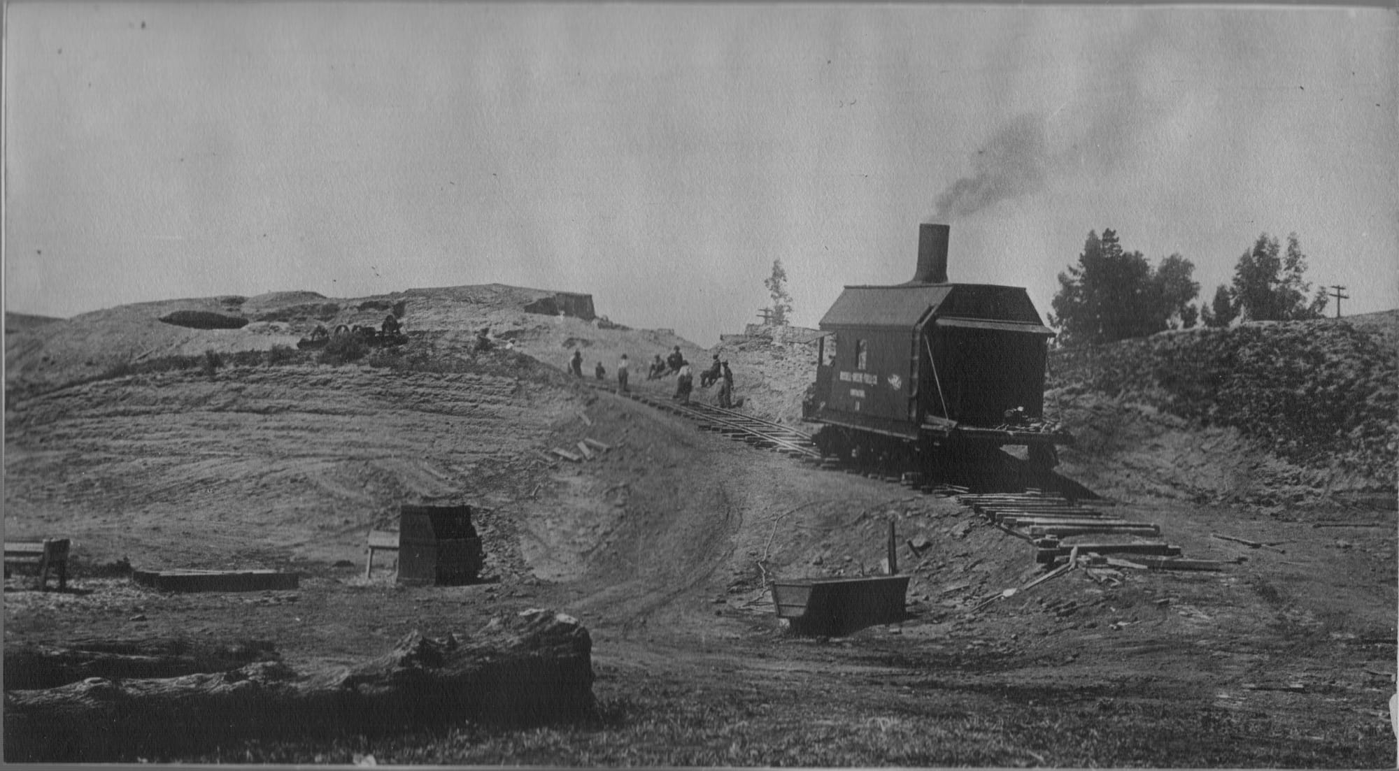
The Daily Press announced that the steam shovel work on the fill would be finished and that the last wagonload of dirt would be dumped on October 1, 1912. Street Superintendent Darling announced that work would not start on graveling and oiling the street, but it would take a year for the street to properly settle before final work could be carried out.
Riversiders then had a direct link along Magnolia Avenue from the southern tip of the city to the downtown area. There was some talk of renaming Main Street to Magnolia Avenue and extending it north to create a 25-mile corridor from Corona to Rialto. This would necessitate a new numbering system for all of Magnolia, with the number 100 beginning at First Street. This plan did not come to fruition. Instead, New Magnolia Avenue originally split shortly before Fourteenth Street, connecting with both Market Street and Main Street, both of which kept their historic names. The extension of Magnolia also accelerated the development of the area, which became the Wood Streets.
After the completion of the fill, the Pacific Electric, which had bought out the old Riverside and Arlington Electric Railway, opened negotiations to obtain a right-of-way along the extended Magnolia Avenue all the way to Corona.
Today, Magnolia Avenue has seen countless changes. Many of the old homes have been replaced with smaller homes, apartment complexes, and numerous commercial enterprises. Various businesses grouped together to form shopping and business districts, such as Magnolia Center, centered around the intersection of Magnolia, Central, and Brockton Avenues, which emerged by the early 1920s. What remains is that Magnolia Avenue is the Backbone of the City, extending from the downtown area at Fourteenth Street to the southern boundary of Riverside and even beyond.


