
🗞️ Riverside News- June 17, 2026
Wednesday Gazette: June 17, 2026 Hello Riverside, and Happy Wednesday! We want to be straight with you: we've
Wednesday Gazette: June 17, 2026 Hello Riverside, and Happy Wednesday! We want to be straight with you: we've

John "Jack" Tortes Meyers was Riverside's own — a Cahuilla catcher who rose to become a bona fide major league star and never forgot where he came from.
The council filled a vacancy open since April 2025, but critics say it sacrificed transparency to do so.

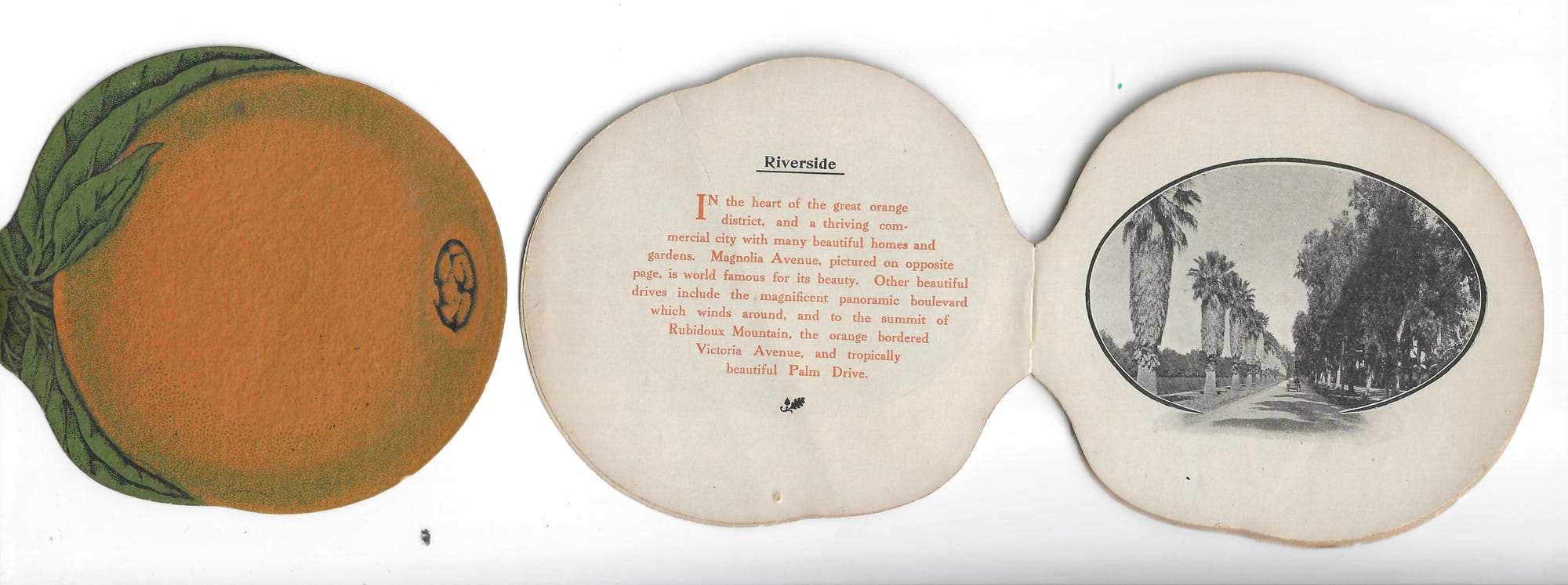
The story behind Magnolia Avenue's grand design, its presidential cross streets and the settlers who made it Southern California's most celebrated boulevard.


With Samuel C. Evans, Sr.'s arrival in 1874, the landscape and size of Riverside changed. With other investors, including William T. Sayward, Evans purchased land south of what is now Arlington Avenue. Needing water, the new syndicate sought help from John W. North and the Southern California Colony Association. North was opposed, so Evans and company formed the Riverside Land and Irrigation Company. They purchased a controlling interest in the Southern California Colony Association and built the Upper Canal to bring water to their new development. They formed the Riverside Land Co. to market the properties to new settlers. This brief, simplified overview of the land associations in the 1870s lays the groundwork for the main topic, Magnolia Avenue.
William T. Sayward envisioned a long avenue, Bloomingdale Avenue, cutting through the property, extending from the base of the Temescal Mountains all the way to San Bernardino. His grandiose idea did not materialize due to the cost and difficulty of obtaining the land for the right-of-way. He had to settle for a grand avenue extending through the property of the Riverside Land and Irrigation Company.
With Samuel Evans back in Fort Wayne, Indiana, in 1875, the management of the Riverside Land and Irrigation Company fell to Evans' brother-in-law, Henry J. Rudisill. Rudisill was responsible for laying out the plans for Magnolia Avenue and the streets connected to it. His wife, Elizabeth Evans Rudisill, suggested the name "Magnolia." The original plan was to plant Magnolia trees along the avenue. However, their high cost and water requirements prevented this. Magnolias were planted at the intersections of the avenues with the Presidential streets, where irrigation ditches supplied the required water.
Early historian James Boyd in History of San Bernardino and Riverside Counties wrote:
"This grand thoroughfare, both the pride and glory of Riverside, and the pioneer of the many beautiful avenues in Southern California, was laid out in 1875, and the eastern end of it, some three miles in length, graded and planted with shade trees in 1877….The avenue is on a straight line running south 43 degrees west through the lands of the Riverside Land Company, and on the same course through the lands of the South Riverside Company to the Coast Range of mountains, a distance of some fifteen miles from the place of beginning. It is 132 feet wide and is divided into sidewalks on each side of 20 feet in width, a space of 10 feet for the central row of trees, and two roadways of 41 feet each. Streets 80 feet in width cross it at right angles every half mile and are named after the Presidents of the United States, commencing with Washington on the eastern end of the avenue."
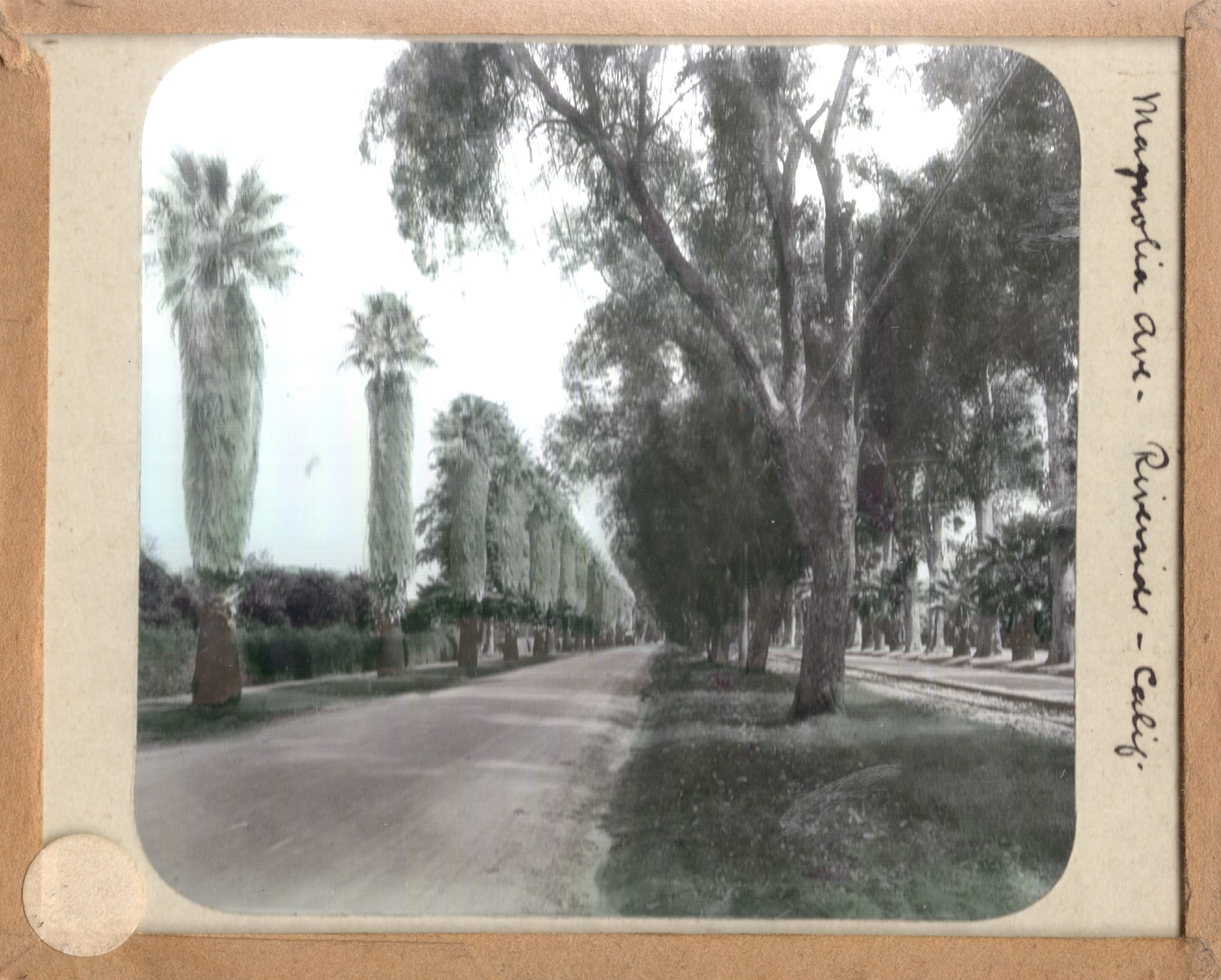
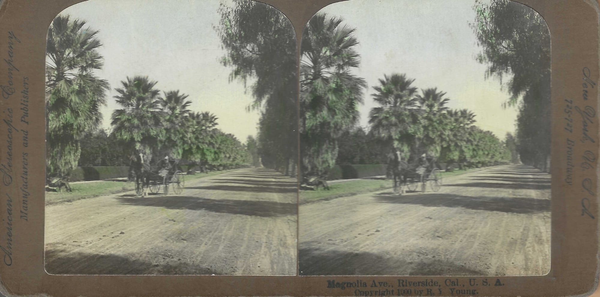
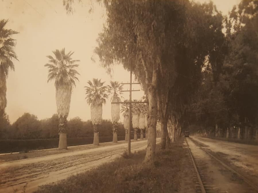
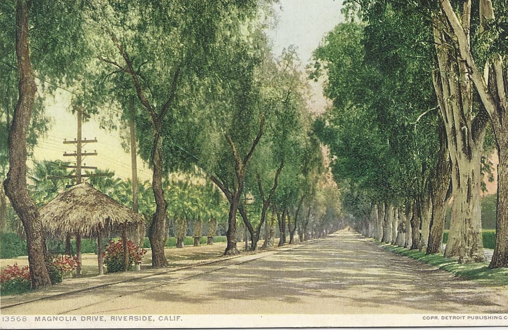
From left: Color Magic Lantern Slide of Magnolia Avenue, Color Stereoview Card of Magnolia Avenue from 1900. (Author's Collection)
Starting at the northeast end of the property, where Arlington Avenue would come, the first cross street was Washington Street. After Washington, the streets did not strictly follow the historical order. John Adams was skipped, and then Jefferson and Madison were reversed at the request of Elizabeth Rudisill. No reason for her request is given. Adams (John Quincy) and Monroe were also reversed. The remaining presidents' names are in the correct order: Jackson, Van Buren, Harrison, Tyler, Polk, Taylor, Fillmore, Pierce, Buchanan, Lincoln, Johnson, and Grant. Grant was the President at that time, so the last main cross street was named Temescal, where the street met the Temescal Wash. Lincoln Street in present-day Home Gardens should not be confused with Lincoln Avenue, which runs parallel to Magnolia Avenue. Later, Johnson Street was renamed McKinley in 1901, shortly after his assassination, and years later, Taylor Street became La Sierra.
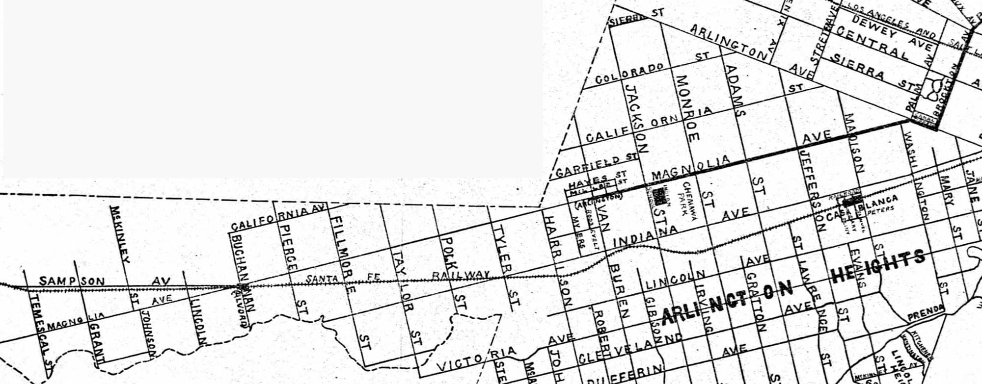
Parallel to Magnolia, a half mile in each direction, two other major streets were laid out, California and Indiana (Evans' home state). Two squares were laid out along Magnolia Avenue as future business districts. The first at the intersection with Van Buren was named Sayward, after W. T. Sayward. The other at the intersection with Lincoln was named Alvord (in present-day Home Gardens). When the area around Van Buren was later developed into a business district, the people renamed it the Village of Arlington.
Boyd was given the contract to grade the streets and sidewalks and to plant the trees, caring for them the first year as they took root. James Boyd, Henry and Elizabeth Rudisill, and Albert S. White spent much time choosing the trees to plant along the new avenue. Initially, they chose pepper trees for the center median and blue gums for the sides. The gum tree proved unsatisfactory, and palms and grevilleas were then substituted.
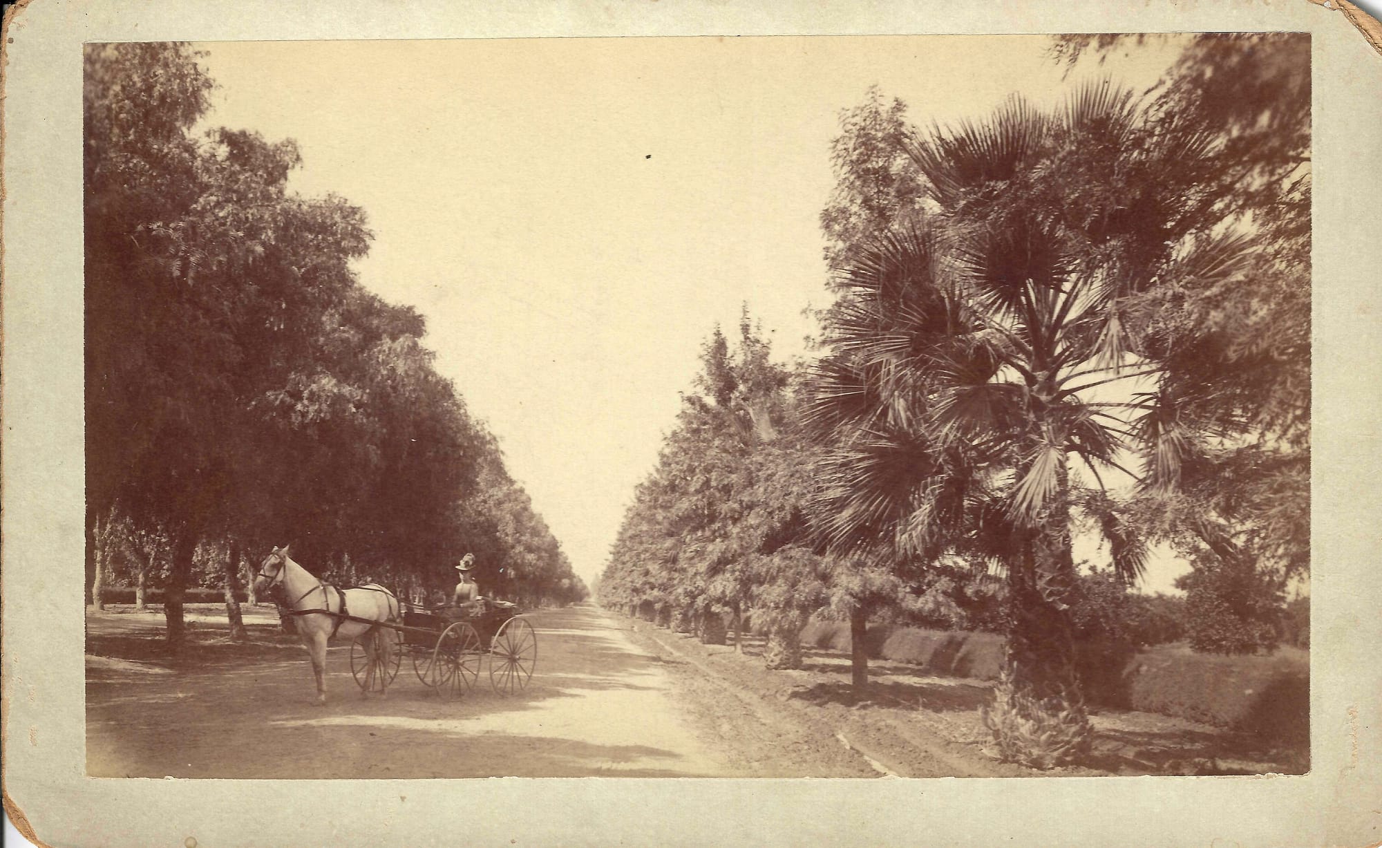
Albert White purchased 40 acres at the corner of Jefferson and Magnolia and planted the acreage in orange groves. He planted a row of fan palms along the Magnolia side of his property, the first person to use palm trees on Magnolia. White never lived on the property but rather remained a guest of his good friend, Frank Miller, first at the Glenwood Cottage and later at the Glenwood Mission Inn.
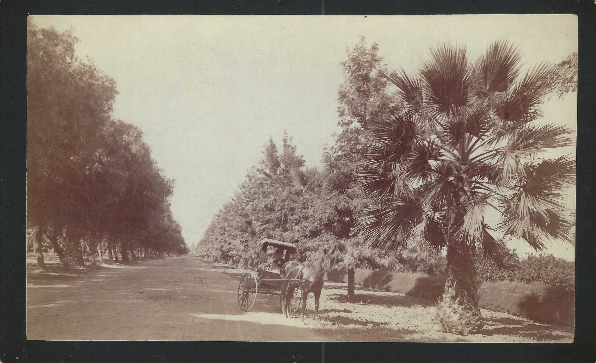
[Early Photo by C.T. Collier of a Horse and Buggy on Magnolia Avenue with a Fan Palm Tree. Pepper Trees line the Center Median. – Author's Collection]
Unlike White, some of the early orange growers who purchased property along Magnolia Avenue did build fine houses for their families as they settled into their new home in Riverside. Throughout all of this, Magnolia Avenue remained the center and showplace of the development. Though the editor of the Press and Horticulturist in December 1878 finds fault and a need for improvement:
"We do not mention this finely laid out avenue to praise it. It needs no encomiums (high level of praise) from us, and perhaps just now deserves none. Broad and straight as it is, adorned as it is beginning to be by fine trees and fine mansions, it is yet open to criticism. It is shockingly weedy. The almost interminable rows of dark-green citrus trees on either side show but poorly to the tourist if he travels in a 'low-wheeled car,' for he sees them only through the brushy tops of enormous weeds, weeds which it takes California to grow in all their glory. But even their transient glory has departed; they line the roadside, a standing army, holding their brown and brittle spears aloft with the imperturbability of the Old Guard."
To serve the residents of the new development and make it easier for them to reach downtown Riverside, the Riverside and Arlington Railway Company was incorporated in 1887 to run from Riverside to the town of Arlington. Initially using mule-drawn streetcars, the line was electrified in 1899. There was no easy, direct, straight line connecting the two ends. The line ran south on Main Street to Prospect, west on Prospect to 14th Street, where it bent westerly to Cypress (today Magnolia Ave). The streetcar then ran south to Bandini, where it turned west until reaching Brockton. There, it followed Brockton to Arlington, then west on Arlington to finally reach Magnolia Avenue. Magnolia Avenue ran straight southwest to Arlington. Along the way, the line later connected to Chemawa Park (built in 1901 and operated by the Riverside and Arlington Railway) and, next door, to Sherman Institute (relocated to Riverside in 1903).
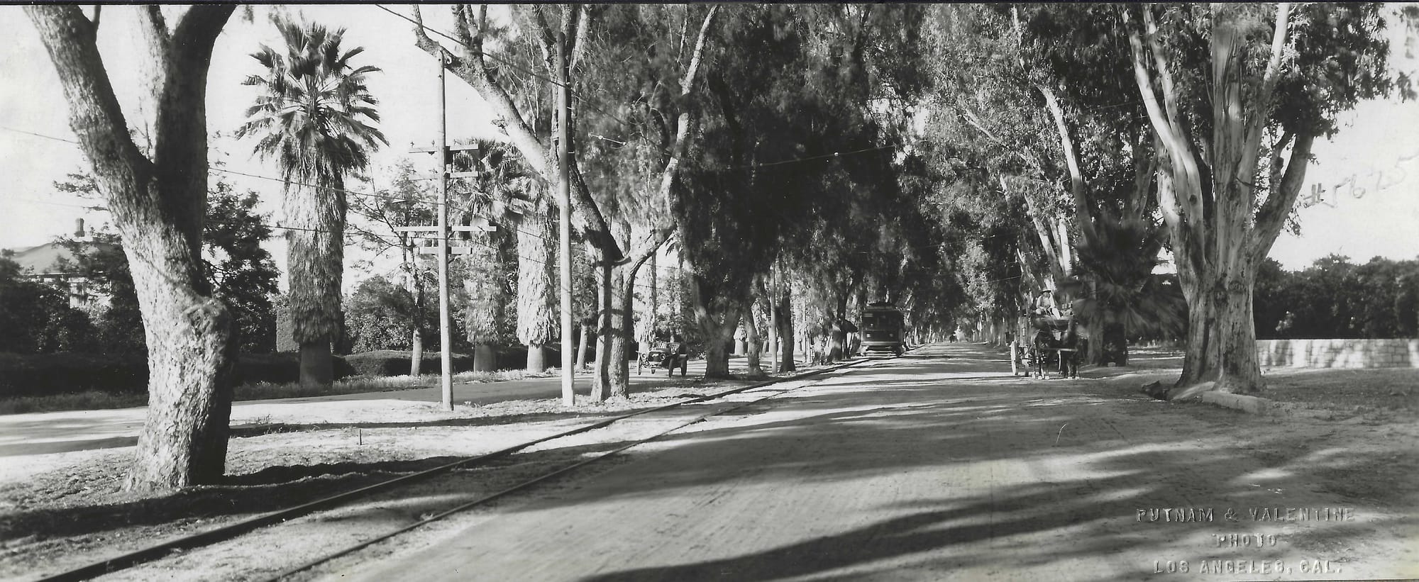
from left: Early Photo by Putnam and Valentine of Los Angeles of Magnolia Avenue looking northeast. Notice the automobile traveling south to the left. There is a trolley coming down the middle, and to the right is a freight wagon loaded with what looks like citrus crates, Photo of People Waiting for Trolley at Brush Covered Shelter, Color Postcard Showing a Brush Covered Shelter. (Author's Collection)
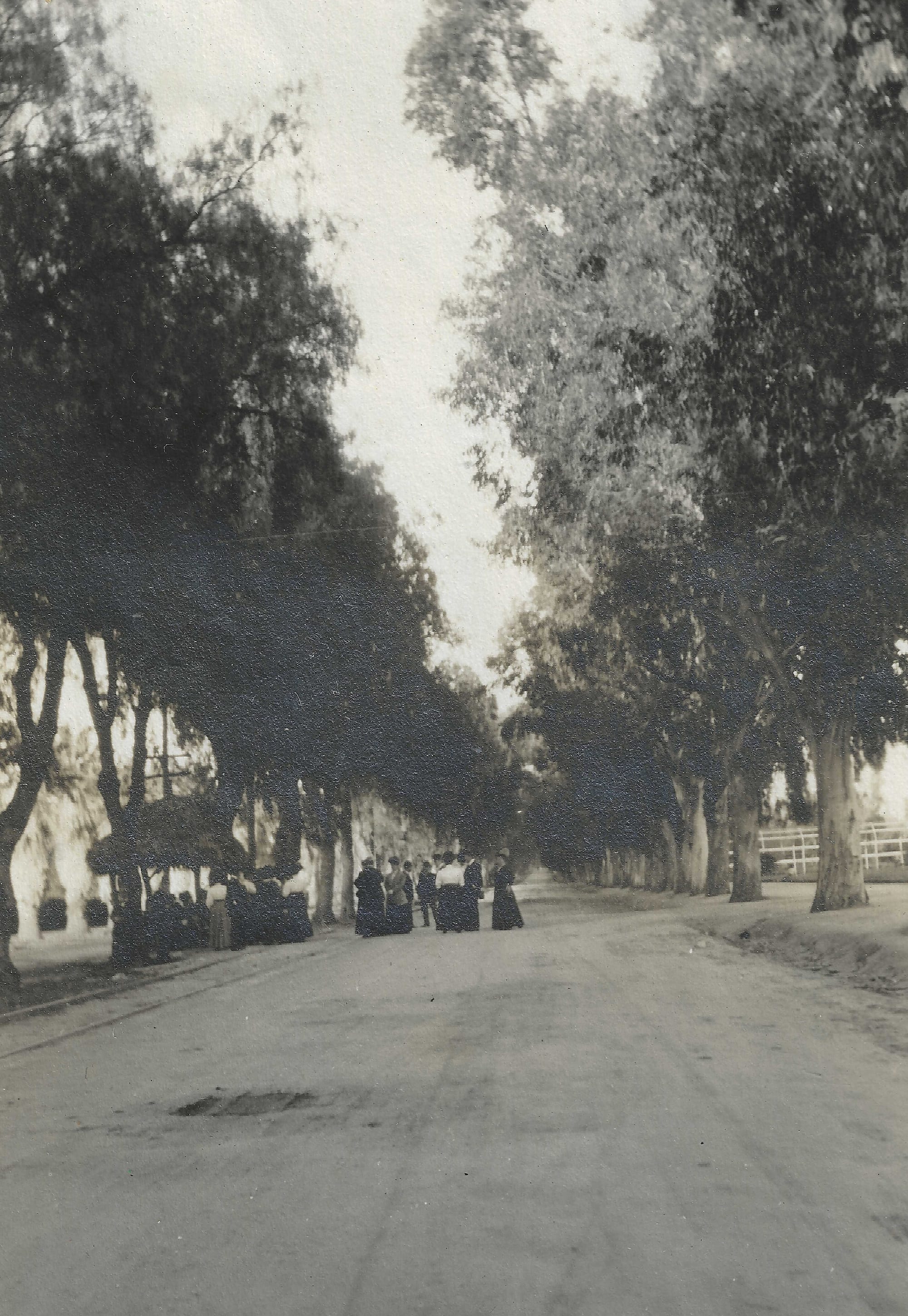
Magnolia Avenue became a tourist attraction for visitors coming to the city. Excursions along its scenic route were promoted by Frank Miller, the Salt Lake Railroad, and others.
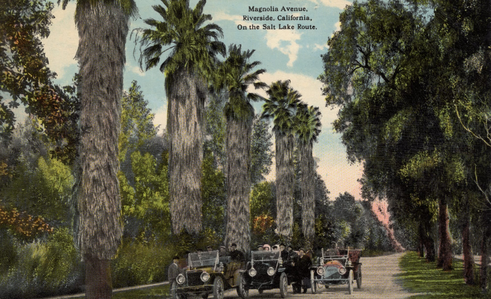
Postcard of Magnolia Avenue, Riverside, California, On the Salt Lake Route (Author's Collection)
A better, more direct street connection for traveling between the land, homes, and businesses along Old Magnolia Avenue and downtown Riverside was needed. But that is another story.

John "Jack" Tortes Meyers was Riverside's own — a Cahuilla catcher who rose to become a bona fide major league star and never forgot where he came from.

Founded in 1879, the church that became Magnolia Presbyterian holds the distinction of housing Riverside's oldest existing church building.

Known to tribal communities as "Chief Buffalo Heart," Jonathan Tibbet spent his life advocating for Native sovereignty at a time when the government called it insubordination.

The horticulturists and entrepreneurs who settled the boulevard in Riverside's citrus heyday left behind a neighborhood and a legacy.
Let us email you Riverside's news and events every morning. For free!